|
Visitor's
Guide to Pinedale, Wyoming |
| Pinedale Online > News > July 2004 > Pinedale area featured on NightLine TV Program > Rendezvous Grounds |
Back to Article © Photo by Pinedale Online |
|
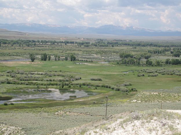
Why is this location called Trappers Point? This knoll has a wonderful view of the historic Green River Rendezvous grounds of the early 1800s! This photo is looking from Trappers Point monument to the west at the Wyoming Range. The Green River meanders from right to left on its way to the Colorado River. Pinedale is behind the photographer about 6 miles. The confluence of Horse Creek and the Green River is just right of center along the 2nd left-right line of trees at the base of the hill. The hill just above centerline is the site of DeSmet Monument and the Daniel Cemetery. The water tower is visible between the two dirt roads that climb the hill. The tiny town of Daniel is in the trees to the right off of the hill. 168 years ago fur trappers and Native Americans camped here for weeks during the Green River Rendezvous. |
|
Copyright © 2004 Pinedale Online. All rights reserved. |