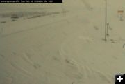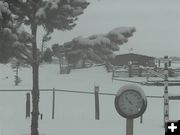
Blustery Marbleton
View of Marbleton and US 189 on Sunday morning, December 30. This cam is sponsored by the Short Stop in Marbleton.
|
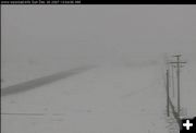
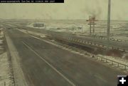
Pinedale Cam
View from the Pinedale webcam on Sunday morning, December 30. This cam is sponsored by Wolf Dodge in Pinedale.
|
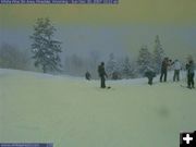
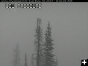
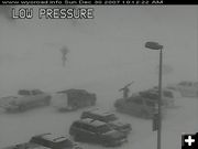
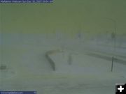
Skiing at White Pine
Skiers and snowboarders are enjoying all the fresh powder at White Pine Ski Area. The ski area got 6 inches of new snow overnight and have a base of 34 inches. 22 trails are open from the Great Spirit Lift.
|
|
Winter Storm Warning
Heavy snow and strong winds expected; 5-10 inches snow in valleys
December 30, 2007
NWS Update: Sunday, December 30, 2007, 8:11PM:
Winter Storm Warning Cancelled for Yellowstone National Park, Teton and Gros Ventre Mountains, Jackson Hole, Wind River Mountains West, Wind River Mountains East, Star Valley, Salt River and Wyoming Ranges, Upper Green River Basin Foothills, South Lincoln County.
____________________________________________
Weather Update: Sunday, December 30, 2007, 11:26 AM:
The National Weather Service has advised they have issued a Winter Storm Warning now in effect until 11 pm mst this evening.
Snowfall of 4 to 8 inches has already fallen over parts of the Wind River Mountains. Winds gusting from 35 to 45 mph with blowing and drifting snow on the mountain passes and peaks. Significant blowing and drifting snow was observed over South Pass.
A strong Pacific storm system continues to move toward western Wyoming. Periods of heavy snow and strong winds will cause significant blowing and drifting snow. Travelers will experience white out conditions especially over mountain passes, including South and Togwotee passes. The snow and strong winds are expected to continue through this afternoon before tapering off. Snowfall of 4 to 8 inches is expected in the Upper Green River Basin foothills with 12 to 24 inches possible over the western Wind River Mountains. The eastern Wind River Mountains are expected to get between 6 to 14 inches with the highest snowfall amounts expected over Togwotee Pass where between 12 to 18 inches could occur. South Pass should receive between 10 and 15 inches.
A Winter Storm Warning means severe winter weather conditions are imminent or highly likely.
____________________________________________
Earlier posting:
The National Weather Service out of Riverton has issued a Winter Storm Warning through 5:00 PM Sunday afternoon (December 30) for the western mountains and valleys of Wyoming.
A strong Pacific storm will continue to bring periods of heavy snow and strong winds Sunday. This combination will continue to cause significant blowing and drifting snow. Travelers will experience white out conditions, especially over the mountain passes. Snow and strong winds are expected to continue through the afternoon hours today before tapering off. Total snowfall of 5 to 10 inches is expected in the valleys with 12 to 24 inches possible in the mountains.
Snowfall of 4 to 8 inches has already fallen over parts of the Wind River Mountains. Winds gusting from 35 to 45 mph with blowing and drifting snow on the mountain passes and peaks. Significant blowing and drifting snow was observed over South Pass.
Snowfall of 4 to 8 inches is expected in the Upper Green River Basin Foothills, with 12 to 24 inches possible over the western Wind River Mountains. The eastern Wind River Mountains are expected to get between 6 and 14 inches, with the highest snowfall amounts expected over Togwotee Pass where between 12 and 18 inches could occur. South Pass should receive between 10 and 15 inches.
A Winter Storm Warning means severe winter weather conditions are imminent or highly likely.
Another storm system may bring significant snowfall to far western Wyoming Thursday night through at least Saturday. Strong southwest winds may develop across the area from eastern Sweetwater County to the Casper area and in the Cody foothills.
|